Modelo matemático del terreno. Aplicaciones forestales
Article Sidebar
Main Article Content
Abstract
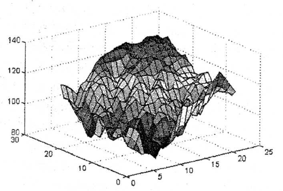
In the current research three Digital Terrain Models {DTMs) were made and evaluated in flat, undulated, and mountainous relief, reaching conclusions related to the quality oj the quantitative resulis attained in each model. The first DTM, as well as the others, was defined upori a regular network, relative to a determined relief. lt is used as a mathematical toolfor the interpolation ofa bilinearpolynomial; this is a particular case of Laqranqe's two-variable interpolation polynomials which the equations used in the biquadratic and bicubic models are deriued from.
In all the cases there is the possibility to redensify the data matrix upon which these there models are defined, starting from the interpolation in transversal sections with a natural cubic spline, what increases the possibility in exactress. These models are highly valuable in the field of forestal engineering, since they will allow the automation of applications sucri as profiles drawing, contour lines maps creation, the determination of the woodland height, and the characterization ofthe gradient in a given relie], among others.
Besides, the possibility to design a road axis by free hand directly in the computer display was creaied, taking into account the technícal standards demanded for its construction, with the altemative to offer the user the coordinates of the stations every 20m, an aspect of key importance for its design and layout on the ground.
In qenerol, all the computerized solutions based onthe 1997 Matlab, version 5.1.0.421, conform a system ofprograms which contribute to the sustained profit of the forest and to the enuironmental conseruation, also facilitating the possibility to analyze alternatives for engineering solutions.
Downloads
Article Details

This work is licensed under a Creative Commons Attribution-NonCommercial 4.0 International License.
Those authors who have publications with this journal accept the following terms of the License Attribution-NonCommercial 4.0 International (CC BY-NC 4.0):
You are free to:
- Share — copy and redistribute the material in any medium or format
- Adapt — remix, transform, and build upon the material
The licensor cannot revoke these freedoms as long as you follow the license terms.
Under the following terms:
- Attribution — You must give appropriate credit, provide a link to the license, and indicate if changes were made. You may do so in any reasonable manner, but not in any way that suggests the licensor endorses you or your use.
- NonCommercial — You may not use the material for commercial purposes.
- No additional restrictions — You may not apply legal terms or technological measures that legally restrict others from doing anything the license permits.
The journal is not responsible for the opinions and concepts expressed in the works, they are the sole responsibility of the authors. The Editor, with the assistance of the Editorial Committee, reserves the right to suggest or request advisable or necessary modifications. They are accepted to publish original scientific papers, research results of interest that have not been published or sent to another journal for the same purpose.
The mention of trademarks of equipment, instruments or specific materials is for identification purposes, and there is no promotional commitment in relation to them, neither by the authors nor by the publisher.
How to Cite
References
ÁLVAREZ, D.; l. EstevEZ; P. CHAVEz; A. F. EGAs; J. M. GARCíA: «Análisis matemático para incrementar la eficiencia en los aserraderos», revista Chapingo, Serie Ciencias Forestales y del Ambiente, IX-2:187-198, 2003.
DoMíNGUEZ, A: «Impactos ambientales de los caminos forestales». Tesis para optar por el título de Doctor en Ciencias, Universidad de Alicante, España, 2003.
DoMiNGUEZ, F.: «Solución de alternativas de aprovechamiento de la madera con impacto reducido mediante técnicas de decisión mullicriterio». Tesis para optar por el título de Doctor en Ciencias, Universidad de Alicante, España.
EGAS, A.; D. ÁLVAREZ; l. Estevez: «Factores funda• mentales para aumentar el rendimiento volumétrico en los aserraderos de Cuba», re• vista Chapingo, Serie Ciencias Forestales y del Ambiente, vol. Vll-2: 163-169, 2001.
EstevEz, l.: «Una aplicación de métodos numéricos en la ingeniería civil». Tesis para optar por el titulo de Máster en Matemática Avanzada para Ingeniería, La Habana, 1998.
GARCíA, R. S.: «Aplicación de los modelos digitales del terreno en ingeniería civil». Tesis doctoral, Universidad Politécnica de Madrid, 1994.
JIMÉNEZ, G. S.: «Un modelo digital del terreno para la proyección de carreteras en Cuba». Tesis para optar por el grado científico de Doctor en Ciencias Técnicas, ISPJAE, La Habana, 1990.
JIMéNEZ, F.: Prácticas de métodos matemáticos para la ingeniería I e introducción al Matlab, Servicio de Publicaciones, Universidad Politécnica de Valencia, España, 1999.
KuDRIAvTsEv, L.· D.: Curso de análisis matemático, t. l, Ed. Mir, Moscú, 1983, pp. 304-308.
LEHMANN, H. C.: Geometría analítica, Edición Revolucionaria, La Habana, 1970.
MouKoRo, E.: «Un sistema para el diseño de canales abiertos para la conducción y evacuación de agua». Tesis para optar por el grado científico de Doctor en Ciencias Técnicas, ISPJAE, La Habana, 1992.
NOTARIO, A.: Investigaciones sobre la planificación general de las redes camineras en los bosques de la República de Cuba con el empleo de métodos de teledetección. Dresden, Dissertation A (Dr. rer. slv.), 1988.
TCHIKOUE, H.; A. NOTARIO: «Sistemas de programas para el cálculo automatizado de un trazado a mano alzada a partir de un levantamiento topográfico directo», V Conferencia Científico-Técnica del MICONS-UNAICC, Pinar del Río, 1990.
TcHIKOUE, H.; l. EsTEVEZ; G. JIMÉNEZ; A NOTARIO: «Una contribución al ajuste matemático de los trazados de los caminos forestales a mano alzada», IV Conferencia Científica del CUPR, Pinar del Rio, 1992.
TcHIKouE, H.: «Trazado de viales forestales mediante la modelación matemática». Tesis para optar por el grado científico de Doctor en Ciencias Forestales, Universidad de Pinar del Río, Cuba, 1996.
VOLKOV, E. A.: Métodos numéricos. Ed. Mir, Moscú, 1992.